The United Republic of Tanzania is tucked in conveniently below the Horn of Africa, alongside the Indian Ocean. In this article, we’ll look at our Tanzania map in terms of geography, political divisions, and historical context. Of course, we’ll also introduce maps of the major sites such as Dar Es Salaam. In addition, you will know where to locate Zanzibar and Pemba, as these islands were part of the final unification of Tanzania as a modern state.
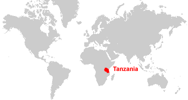
Tanzania Map Basics: Political Borders
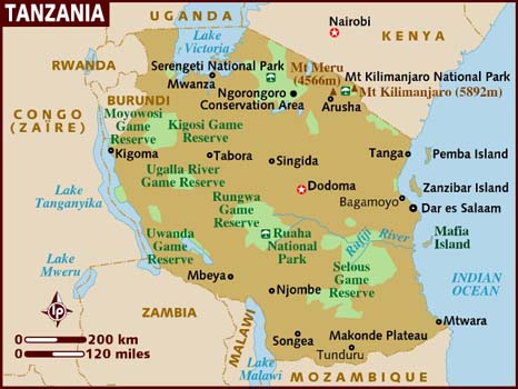
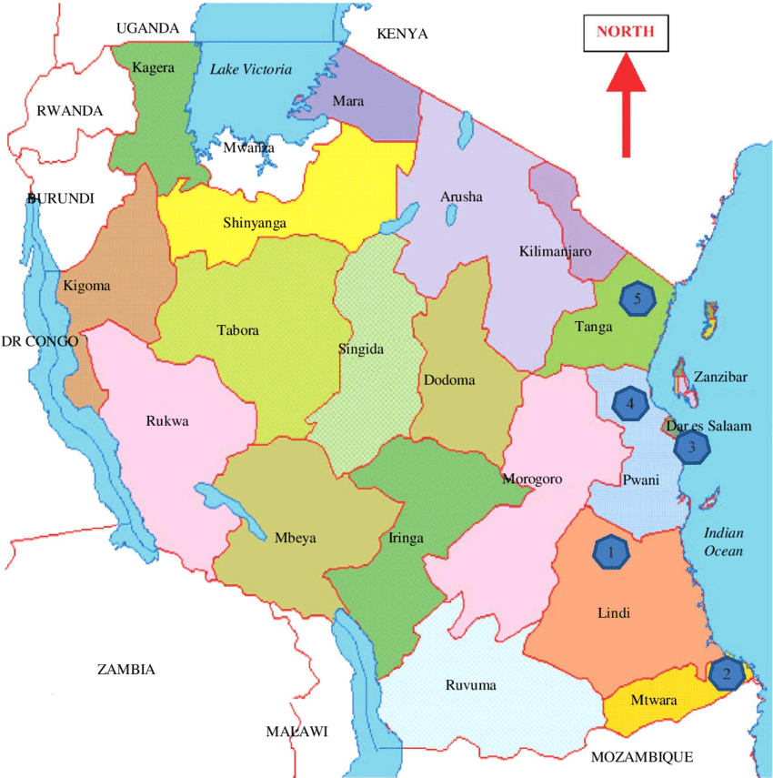
Tanzania borders eight countries. To the north, Tanzania borders Kenya and Uganda. Burundi, Rwanda, and the Democratic Republic of Congo border Tanzania’s west. While Malawi, Mozambique, and Zambia are to the south. As an East African nation, Tanzania has a coast line along the Indian Ocean that stretches 1,424 kilometers (885 miles). This has made it ideal for seafaring and maritime trading. Off the coast there are the major islands of Zanzibar, Pemba, and Mafia. Yes, there is a Mafia Island off the coast of East Africa! Refer to the Tanzania map above.
To the north, there is Kilimanjaro National Park which is home to Mt. Kilimanjaro. Africa’s highest point lies at the peek of this mountain at 5,895 meters, or 19,341 feet high! Tanzania is also home to Africa’s lowest point at Lake Tanganyika which lies 1,471 meters, or 4,826 ft below sea level.
Geographical Features
Central Tanzania consists of a large plateau, with plenty of lush soil for farming. The East coastal geographic area is humid and warm with the Zanzibar archipelago in the East. The northwest consists of rugged terrain and dense forests. This is plausible since this is the location of the mountainous area of Mt. Kilimanjaro. Lake Victoria is located in the north, while Lake Nyasa is situated in the southwest.
In terms of administrative divisions, Tanzania is divided into 31 regions, 5 of them being on Zanzibar, while the other 26 are on the mainland.
Mainland: Dar Es Salaam
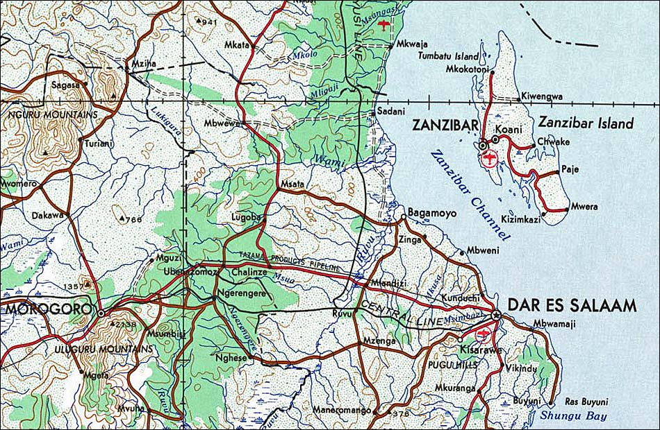
Dar Es Salaam is the central hub where most travelers start their journey in Tanzania. Whether your goal is to climb Mt. Kilimanjaro up north, or to lounge on the beaches of Zanzibar, Dar Es Salaam offers the utilities of a modern rising city, and is a good home away from home as you navigate through Tanzania’s lush and vibrant terrain. Julius Nyerere International Airport is where you will land, and is easy to remember as it is named after Tanzania’s founding father. Want to learn more about Julius Nyerere and his philosophical foundations? Check out our Young Pioneer Tours socialist countries article. Fast forward down the table of contents to find the section about the United Republic of Tanzania and African socialism.
The Islands: Zanzibar
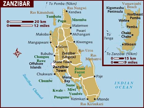
Now we’ve talked about Tanganyika, which is mainland Tanzania. Let’s take a look at one of the world’s famous most vacation resorts: Zanzibar! Tourism is a central aspect of the economy here. Most people arrive at Abeid Amani Karume International Airport located on the west side of the island around Zanzibar town. Though, Zanzibar has an international airport, most people arrive at Dar es Salaam and take a ferry to Zanzibar. Tourism outpaces agriculture for income and takes up to 25% of Zanzibar’s total income. Check out this link for more practical information and what to consider before you embark on your trip in Zanzibar. There’s a lot more to do rather than lounge on the beach!
The Zanzibar Channel lies to the west of the island. The southern entrance to the channel is located about 22 kilometers from Dar Es Salaam. The best way to know the location of the entrance is to identify the lighthouse on the Ras Kanzi promontory. This channel has a rich history of trade between the island and the mainland. If you’re curious about the event that caused Freddy Mercury’s family to flee Zanzibar, check out this article on the Zanzibar Revolution.
Please consider the Tanzania Safari Tour and the Zanzibar Revolution Tour for your next holiday with Young Pioneer Tours!


