Officially known as the Republic of Croatia, this beautiful, historic nation is situated along the Adriatic Sea and has been an independent country since 1991.
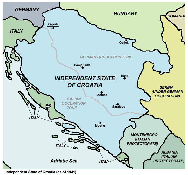
However, Croatia’s origins as a distinct state date back to the 7th century. Despite evolving borders and periods of foreign rule – including its time as a constituent republic within Yugoslavia – a Croatian state has continuously existed in some form throughout. This is shown on the Croatia Maps.
Croatia is a country of diverse regions, each with its own distinct identity. From the bustling capital of Zagreb to the historic coastlines of Dalmatia and Istria, as well as the lush landscapes of Slavonia, each region contributes to the vibrant mosaic that makes up modern Croatia.
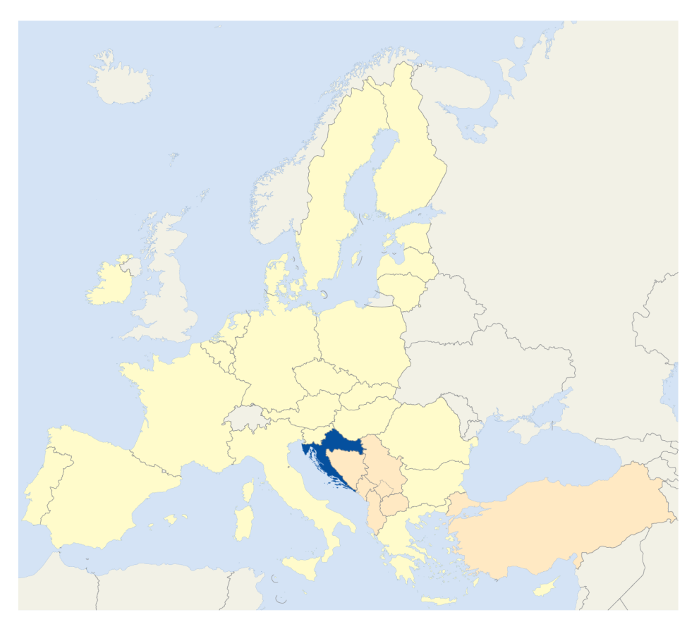
But where is Croatia? For those looking at the country on a map, however, its strange shape is likely the first thing that stands out. Croatia has even been nicknamed “the boomerang” or “the horseshoe” for the way it wraps around Bosnia while hugging the Adriatic coast.

In fact, this means that the geographic centre of the country can, bizarrely, be found on Bosnian territory. The history of Yugoslavia, its disintegration, and the intertwined relationship between Croatia and Bosnia means this is an irony not lost on just political and geography nerds.
To better understand Croatia’s unique geographic and cultural position, we’re providing some thought-provoking maps of Croatia, alongside some context related to them. This aims to give insight into Croatia’s strategic location, how the country is organized, the location of major cities and attractions, as well as how these have evolved through time.
Table of Contents
So… Where is Croatia?
Croatia covers an area of 56,594 km² and a population of just under 4 million. Located at the crossroads of Central and Southeast Europe, the country stretches from the flatlands of Slavonia to the stunning Adriatic coastline in the west. It can also boast over a thousand islands, scattered amongst the clear blue waters of the Adriatic Sea.

For a (comparatively) small nation, Croatia is extremely geographically diverse. Its landscapes include the mountainous Dinaric Alps, the romantic Plitvice Lakes, and some of Europe’s largest wetlands.
This positioning has given Croatia a rich tapestry of cultural influences, from Roman and Venetian to Ottoman and Austro-Hungarian, all of which have occupied this land at some point. This history is layered into Croatian architecture, cuisine, and customs.
How is Croatia Organized?
Croatia is divided into twenty-one counties, each with its own local government and administrative structure.
Known in Croatian as županije, each one roughly corresponds to a historical region within the country. Each has a central city or town that acts as the governmental seat, allowing them to maintain a degree of autonomy while remaining a part of a unified Croatian state. Each county elects a prefect, who serves as the head of the local government.

The largest county by population is the city of Zagreb, with almost 800,000 people. The least-populated is Lika-Senj, a mountainous region on the mid-Adriatic coast, which has less than 42,000 people. They are also the smallest and largest by area respectively, with Lika-Senj being over 8x the size of Zagreb.
Population and Cultural Distribution on Croatia Maps
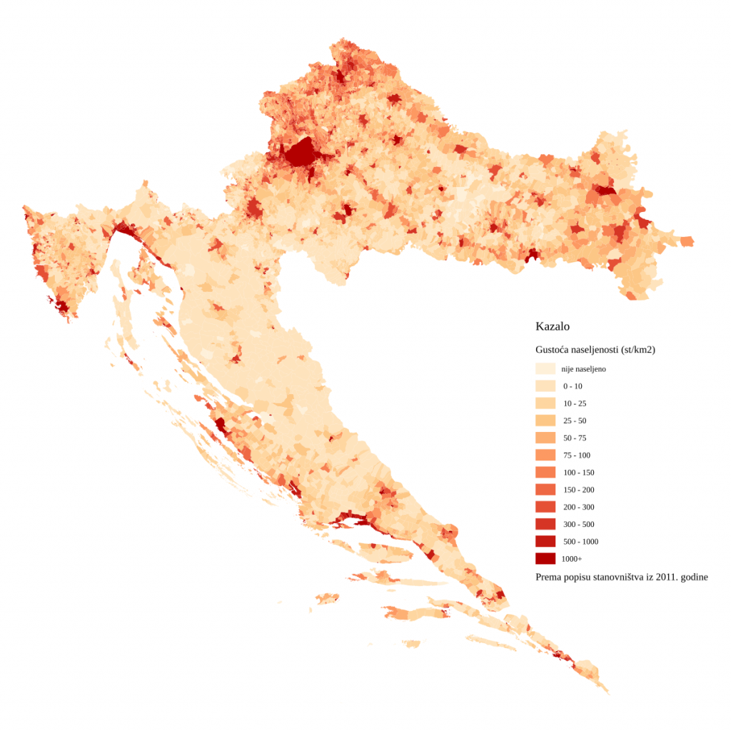
Croatia has a relatively low population density of around 72 people per km². Most people reside along the thin Adriatic coastal trip or in major inland cities, especially Zagreb.

The largest cities include Zagreb, Split, Rijeka, and Osijek, each contributing to the country’s rich cultural and economic life.
The Adriatic islands, though movingly beautiful, are sparsely populated, and those who live there often are part-time residents.
Maps of Major Cities and Transportation
Croatia’s cities are rich in history and beautiful, unique architecture. While tourism mainly revolves around Dubrovnik’s medieval walls, Split’s Diocletian Palace, and the majestic city of Zagreb, there is so much more to Croatia than this!
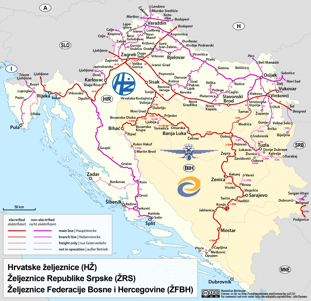
Rail transport is less developed than in some European countries, but Croatia’s rail network connects Zagreb with key regional cities and international borders.

Croatia’s public transportation includes buses and ferries, which connect mainland cities to the islands. Hitchhiking is much more common here than in other European countries, and this is a common way to get around.
Major airports in Zagreb, Split, and Dubrovnik also connect Croatia to the rest of Europe and beyond. Since 2023, Croatia has been a member of the continent’s Schengen zone, abolishing border controls with much of the rest of the EU.
Croatia’s Borders and Regional Influence
The nation is bordered by Slovenia, Hungary, Serbia, Bosnia and Herzegovina, and Montenegro while also sharing a maritime border with Italy. Its long coastline and position in the heart of the Balkans means that the country punches above its weight in terms of its geopolitical influence.
As a member of the European Union and NATO, Croatia maintains strong connections with its neighbours and actively participates in European and global matters.
Croatia’s proximity to Italy has led to centuries of cultural exchange across the Adriatic. Historically, it shared ties with Hungary and Austria, being part of the Austro-Hungarian Empire until its dissolution in 1918.


More recently, Croatia has been a crucial part of the stability in the Western Balkans, balancing a diverse set of alliances with both the EU and its Balkan neighbours.
From a soft power perspective, Croatia has been promoted by many in the EU as an example of successful post-conflict reconstruction in the former Yugoslavia. This has been to the benefit of pro-European political parties in countries such as Montenegro, Serbia, and Bosnia.
How can I see Croatia for myself?
We hope that this variety of Croatia maps will inspire you to discover Croatia for yourself! If you’re still unsure of the best way to do this, why not consider joining our Ultimate Yugoslavia Tour? We run this adventure twice a year in May and November, offering a deep dive into all seven of the former Yugoslav republics. Of course, this includes a night in Zagreb and a road trip through Croatia!
For a more personalized experience, we can craft a custom Croatian itinerary to align with your specific interests. While the country has become very popular in recent years, many hidden gems require insider knowledge to uncover, which you can do with our experienced local guides. For more details, visit our Croatia page or send us an email, and we’ll construct the trip of your dreams!


