Officially known as the Union of Soviet Socialist Republics (USSR), the Soviet Union was a vast and influential state that existed between 1922 to 1991. Although it may no longer exist, its legacy continues to shape the countries that emerged from its collapse.
The USSR was comprised of 15 national republics for much of its history. These included Russia (the largest and most powerful), Ukraine, Belarus, Moldova, the Baltic states (Estonia, Latvia, Lithuania), the Caucasus (Armenia, Azerbaijan, Georgia), and the Central Asian republics of Kazakhstan, Uzbekistan, Turkmenistan, Kyrgyzstan, and Tajikistan.
To better understand this massive entity, maps were a favourite tool for Soviet planners and citizens alike. By analyzing them, we can gain insight into the USSR’s global positioning, as well as its internal structures, extensive natural resources, population density, and location of major cities. Through these lenses, and especially with a map of the USSR, the nations’ complexity and its global reach become more apparent.
Table of Contents
Some Soviet Geography – Where in the world was the USSR?
For much of its history, it was the world’s largest country, comprising 22.4 million km2, over double that of the second-largest country, Canada.
The Soviet Union was primarily located in Eastern Europe, as well as Northern and Central Asia, collectively known to this day as Eurasia. It stretched from the Baltic Sea in the west to the Pacific Ocean in the east, and from the Arctic Ocean to the borders of Afghanistan, China, and Iran in the south.
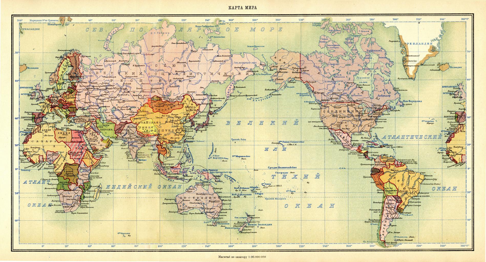
From its capital of Moscow – which modern Russia has inherited – the USSR’s vast sweep encompassed diverse climates, landscapes, and cultures. This made it one of the most geographically and ethnically varied states in the world. Given this, the Soviet Union also controlled vast natural resources, which were used against the United States during the Cold War.
At its peak, it had a population of 290 million and covered 1/6th of the world’s surface. The country spanned eleven time zones, bordered twelve states, and included hundreds of spoken languages and dozens of ethnic groups.
How was the USSR organized?
When it collapsed, the USSR was comprised of fifteen Soviet Socialist Republics (SSRs).
These roughly corresponded to the different major ethnicities in the country. For example, ethnic Armenians lived primarily in the Armenian SSR, while the Kyrgyz population lived largely in the Kyrgyz SSR.
Each of these was a constituent republic within the Soviet Union, meaning that they were given autonomy and considered a “nation-state” of their respective group while remaining under the Soviet “umbrella.”
This is comparable to how the UK is comprised of four “nations,” which retain a national character under the wider British identity.
In reality, though, the Soviet Union was highly centralized, and many major decisions were taken in Moscow, not the Republics.
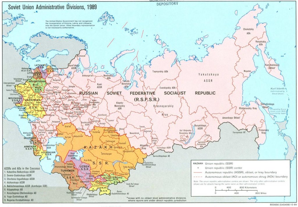
By far, the largest of these SSRs – both in territory and population – was the Russian Soviet Federative Socialist Republic. This corresponded to the modern territory of Russia today and was home to 150 million people across 17 million km2 of territory.
The smallest republic in terms of population was the Estonian SSR, with around 1.5 million residents. Territorially, it was the Armenian SSR, with an area of 29,800 km2.
Each republic within the Soviet Union had its own First Secretary, who served as the head of both the Communist Party and the government. Typically, these leaders came from the dominant ethnic group of their respective republics. However, during periods of political instability or crisis, exceptions were made, and individuals from other ethnic groups were sometimes appointed to these key positions.
Furthermore, many of the SSRs were then divided further. The most autonomous of these were the Autonomous Soviet Socialist Republics (ASSRs). Generally, these were the “homelands” of smaller ethnic groups and were given a degree of self-governance while remaining under the control of a larger entity. Examples of these include the Abkhaz ASSR within Georgia, where the Abkhaz ethnic group dominate, and the Tuvan ASSR within Russia, home to the Tuvan people.
Population distribition in the USSR:
The Soviet Union had a relatively low population density, with an average of 12.7 people per km2. For comparison, the USA has around 38 people per km2 today, while city-states such as Singapore have around 8,000 per km2.
However, this was very unevenly distributed across the country. About half of the USSR’s population lived in Russia, while most Soviet citizens lived in Eastern Europe. Large expanses of Siberia and Central Asia remained an uninhabited wilderness.
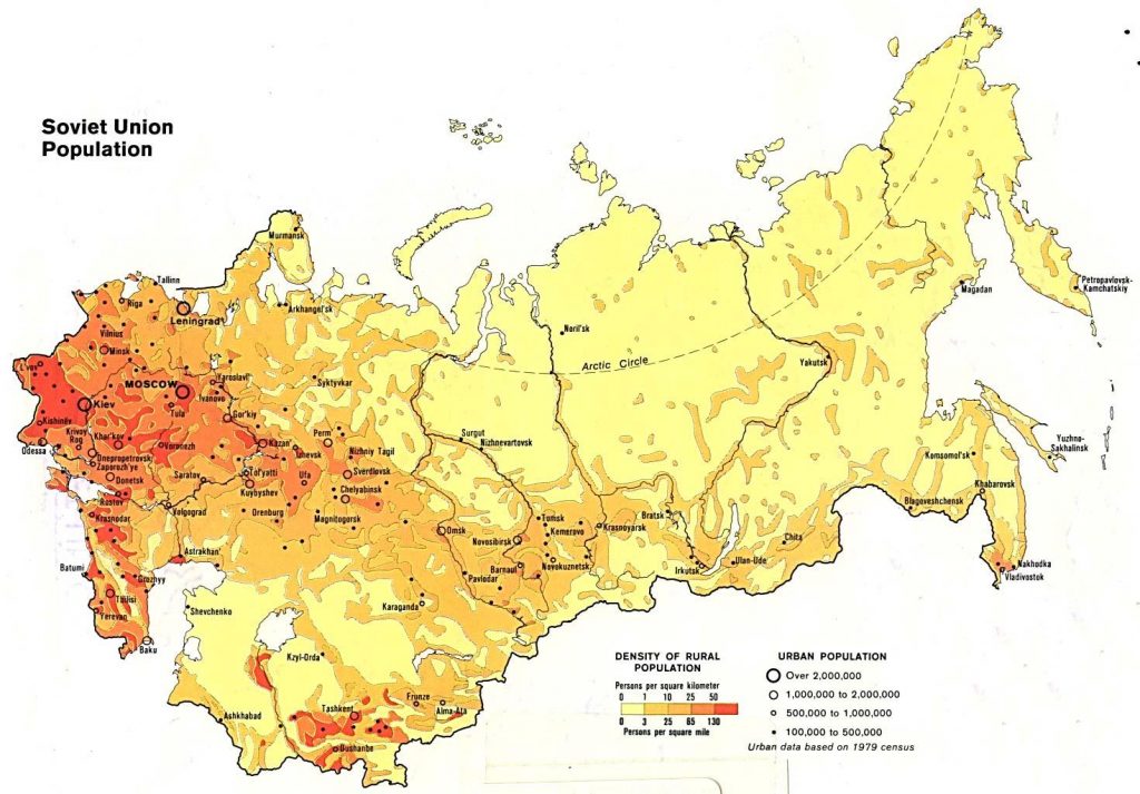
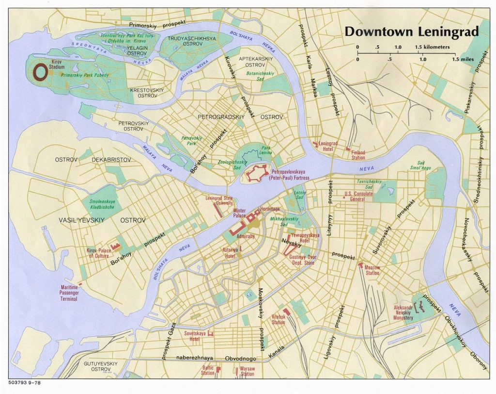
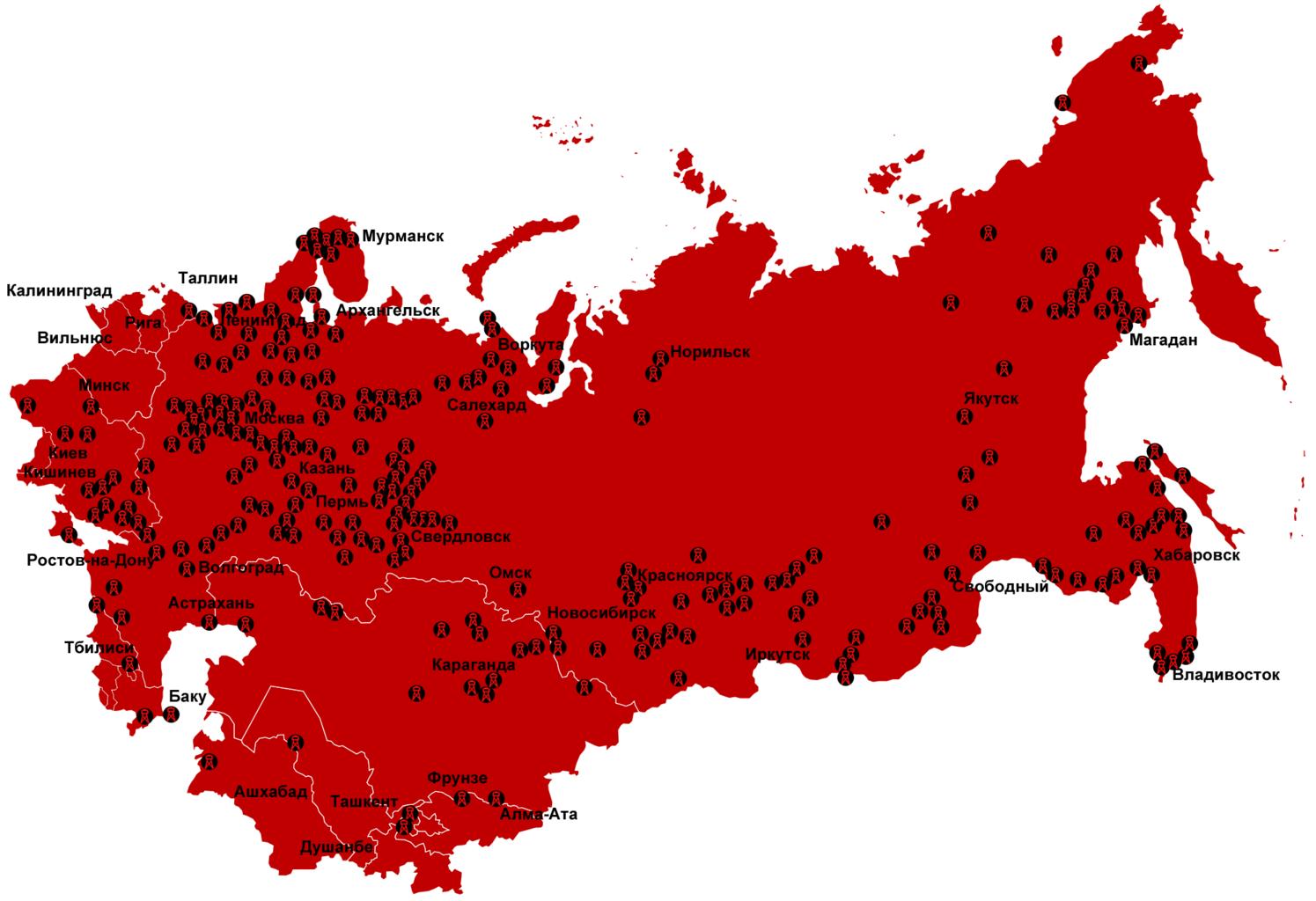
The biggest cities in the country were Moscow, Leningrad (St. Petersburg), Kyiv, and Tashkent. The Industrialized Donbas of Eastern Ukraine, as well as the Ferghana Valley in Central Asia, were also densely populated.
What about some maps of the major cities?
There was very little tourism to the USSR, and that which did exist was tightly controlled and limited to the jewels of the country. Almost all visitors were restricted to the splendour of Moscow and Saint Petersburg, where international flights operated from.
A lack of supplies and the particularities of the Socialist system meant that there were few cars on the nation’s roads. Instead, cities were built with vast boulevards and parks around a public transportation system. These included metros, trolleybus, and marshrutka (minibus) networks, which were heavily subsidized and, therefore, ridiculously cheap!
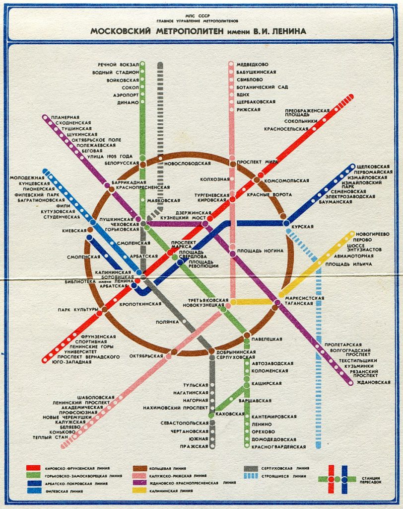
Given the Soviet geography of being the world’s largest country, planes and trains were utilized to transport citizens across vast distances. Compared to the time of the Russian Revolution, the length of the rail network doubled, and passenger numbers increased tenfold.
Almost all the USSR’s freight was transported by rail, given that the country lacked the highway network of the United States. It was not uncommon to take trips by rail lasting weeks across the country, most famously on the Trans-Siberian Railway.
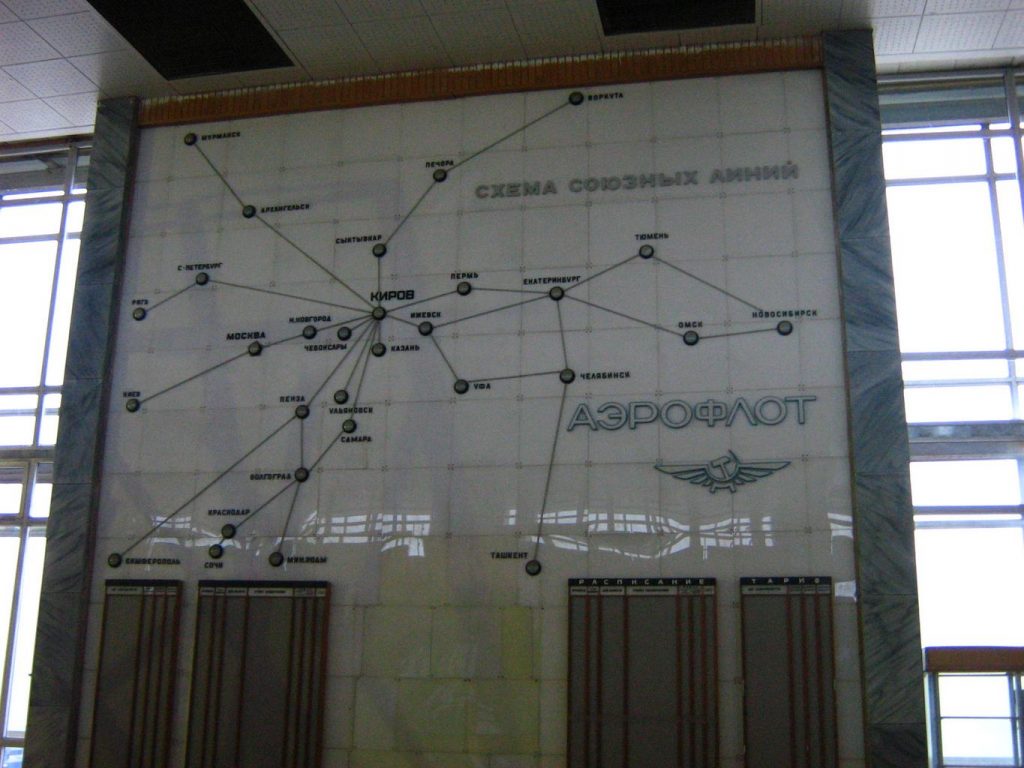
Aeroflot was the national airline and flew passengers on routes as long as 9 hours within the country. Only the privileged had access to this network, as fuel was often in short supply.
While the USSR may be no more, Aeroflot retains the hammer and sickle logo to this day!
What about the USSR’s borders?
While the USSR was an enormous entity in itself, this did not mean that Soviet influence ended at its national borders.
As it shared frontiers with twelve states, Soviet control spilled over into almost all of these nations. Mongolia, for example, was effectively a Soviet satellite state, while the Eastern Bloc of nations in Eastern Europe were also under the political, economic, and military control of the USSR despite remaining nominally independent.
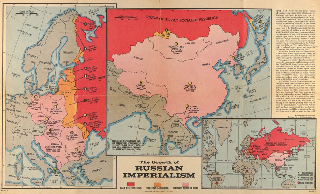
North Korea was established in the 1940s as a buffer between the USSR and the West. While China became a communist state in October 1949, the two countries always had a culturally and ideologically fractious relationship, leading to the Sino-Soviet split in the 1960s.
Generally, it was very difficult to cross the land borders of the Soviet Union, although they were slightly easier in Eastern Europe. There were even “internal” checks for travel between republics and even cities.
Can I still visit the USSR?
Unfortunately… no.
The USSR famously collapsed in 1991, ending the Cold War and resulting in independence for the fifteen republics that comprised it.
However, YPT probably is able to give you the closest thing left to a Soviet vacation! Not only do we offer group tours to every single one of the former Soviet republics, but we also go to many of the unrecognized countries created as a result of the union’s collapse, such as Abkhazia and Transnistria.
Many of our tours also have a Soviet history focus. You can check our Soviet Tours here to get a taste of what it must have been like to visit the Soviet Union. And if our group tour dates don’t work for you, or you want a more “specialized” itinerary, then let us design a private tour for you!