Tibet Map
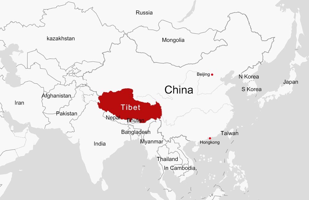
So where is Tibet? What is Tibet? This is a highly contested topic, and I’m sure whoever is reading this will have differing opinions. This article will focus on Tibet’s current geopolitical borders as the Tibetan Autonomous Region, and will also give hints to the historical regions of Tibet and where ethnically Tibetan people reside.
Tibet is bordered by India, Nepal, Bhutan, and Myanmar (Burma). The Tibet Autonomous Region is located in Southwestern China. The geographical region is famous for the Himalaya Mountain Range, whose glacier water is the source of 8 rivers, including the Yangtze and Yellow Rivers which replenish China. The Indus, Ganges, Brahmaputra, Irrawaddy, Salween, and Mekong Rivers have their origins here too.
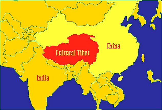
Historically, the Tibetan cultural sphere expanded beyond the current borders of the Tibet Autonomous Region. Tibet consisted of many parts of western and southwestern China where there are still large ethnic Tibetan enclaves. These areas have been incorporated into separate Chinese provinces. Qinghai Province (Amdo) and parts of Sichuan and Yunnan provinces (Kham) are examples of these areas. What we know today as geopolitical Tibet is referred to as U-Tsang by Tibetans.
Qinghai
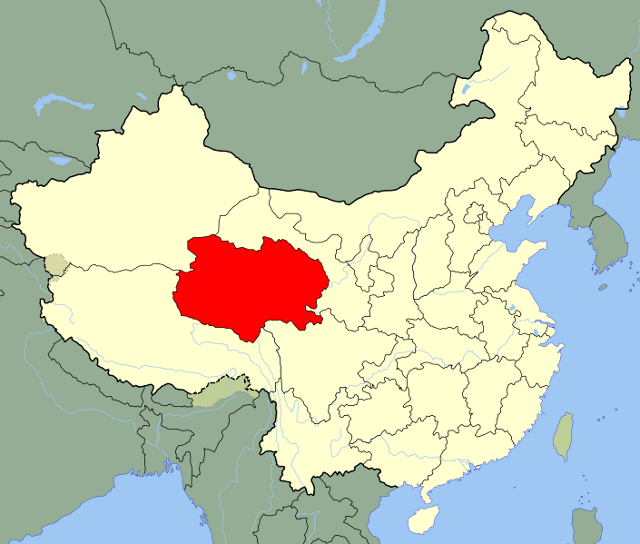
Out of all of the major regions, I’ll choose to write a bit about Qinghai since it conjures up fond personal memories. If you ever travel to the city of Xining, you’ll be in the capital of Qinghai Province. The capital lies on the outskirts of the tranquil and famous Qinghai Lake. Qinghai is famous for its Tibetan monasteries and villages. Repkong ཐུང་རིན་གྲོང་ཁྱེར། (aka Tongren同仁 in Chinese),and Xiahe, Gansu Province 夏河བསང་ཆུ་ with Labrang monastery are two locations that attract many tourists both within China and from the international scene. You’ll notice that there are more Tibetans than any other ethnic group, as Tibetan monks casually carry on their daily routine.
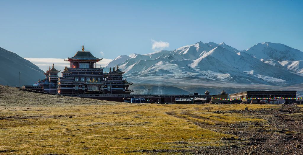
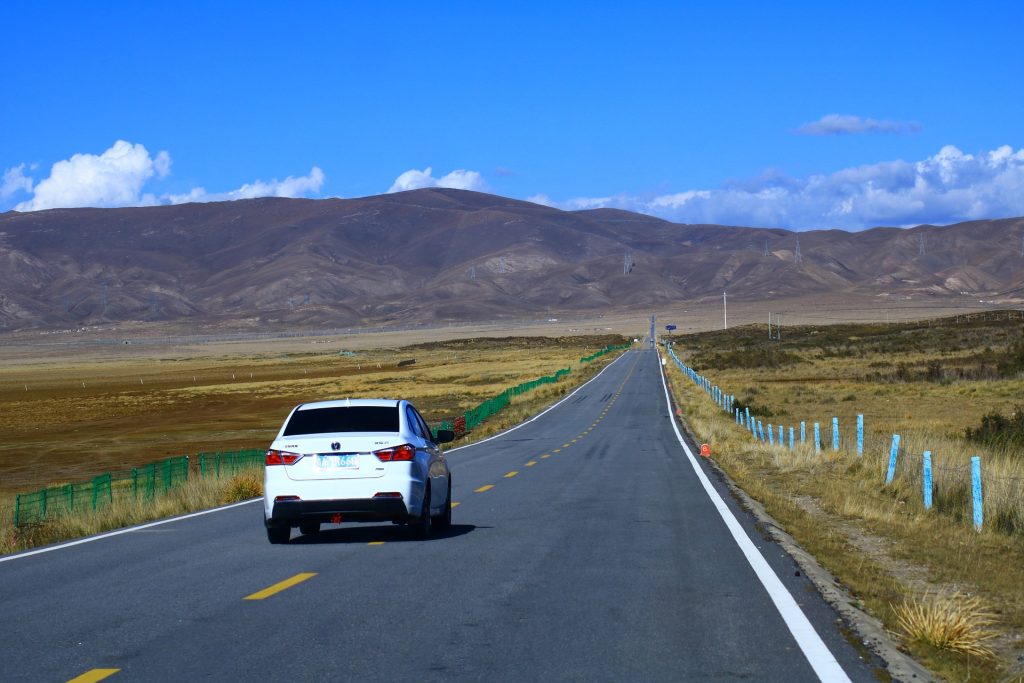
From personal experience, the landscape here is absolutely stunning. You’ll have snow-capped mountains on one side, a desert with rolling sand dunes on the other, a lake in the front, and endless grasslands to the rear. Imagine this all at the same time as you drive aimlessly down a winding road. Talk about a vacation!
Physical Attributes
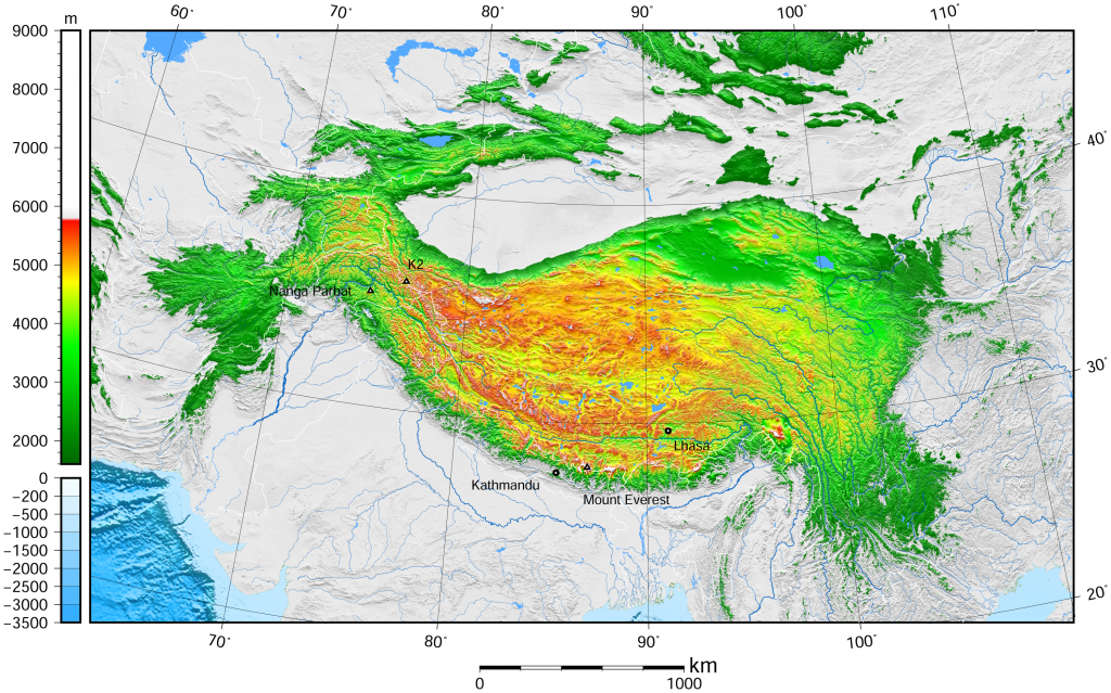
As you may have noticed when referring to the physical map of Tibet, the whole region is well above sea level. The Himalayan Mountain Range extends along the border of China and Nepal, with Mt. Everest being divided between the nations along the summit. The Tibetan Plateau—known as the “roof of the world”— is a plateau that spans across historical Tibet and into Bhutan and northern India. The average elevation is 4,500 meters, or 14,800 feet above sea level. Tibet’s high level and numerous mountains make it arid for farming, so up to 40% of the population consists of nomadic herders.
Linguistic Geography
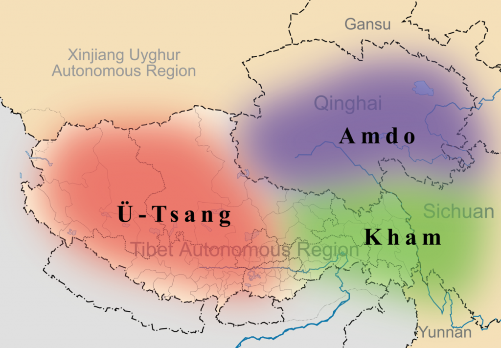
The Tibetan language consists of many different dialects, but the main categories are shown in the linguistic map. The most widely spoken form of Tibetan is the Lhasa dialect, also known as U-Tsang dialect. It is an official language of the Tibet Autonomous Region of China and is named after the capital city, Lhasa. This dialect is the most conservative, due to the religious and spiritual importance of Lhasa in Tibetan Buddhism.
The Kham dialect is spoken in Sichuan, South Qinghai, Yunnan Province, and the eastern most part of the Tibet Autonomous Region. The Kham dialect is tonal, but is not mutually intelligible with other dialects.
The Amdo dialect is primarily spoken in Qinghai, Gansu, and Sichuan Provinces. Amdo is not a tonal language and developed differently due to geography. Geographical isolation is a common feature that affected the development and interaction between different dialects.
Are you interested in visiting the roof of the world with Young Pioneer Tours? Then check out our Himalayan tour here!
Don’t forget to get information on where to go in Tibet first!


